
To support distance learning, Indian Space Research Organisation, Government of India has launched dedicated communication satellite called EDUSAT in 2004. The satellite is widely used for variety of applications like Tele-education, Tele-medicine, Village Resource Centres, mobile satellite services, disaster management support and television broadcasting educating farmers for agriculture and other purposes. One of the prime applications of EDUSAT satellite is tele-education at various levels (i.e. school level/UG /PG level) by different ministries / autonomous organizations / departments/institutions/universities in India effectively utilized the EDUSAT for Tele-education.
- To provide an opportunity for individuals to learn Remote Sensing and Geoinformation Science for the benefit of their professional career. This will allow graduates to build their knowledge and practical expertise in RS and GIS technologies with independent study and project experience at the certificate level.
- To provide considerable flexibility allowing students to quickly gain the RS and GIS knowledge and qualification they need today, and to add to their credentials.
- To empower students undertaking this course to develop their knowledge and understanding through formal coursework and a program of independent reading.
- To undergo Laboratory Practical and Experiments in Cloud Computing Environment
The IIRS outreach programme is being conducted through following two major modes:
- Live and Interactive classroom sessions (also known as EDUSAT) and
- E-learning based online courses.
The live and interactive mode of distance learning is through Internet and indigenous developed e-class platform (https://eclass.iirs.gov.in).
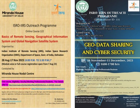
Miranda House – University College for Women, Delhi is registered as nodal centre of Outreach Programmes of Indian Institute of Remote Sensing (IIRS), Indian Space Research Organization (ISRO), Department of Space, Government of India. It offers FREE ONLINE courses on Satellite related Technologies for developing trained students/professionals in the field of Remote Sensing, Geo-informatics and Global Navigation Satellite System (GNSS) technology and its applications in natural resources monitoring, environmental, disaster management etc.
1. Free Virtual mode sessions
2. Experts from IIRS (Indian Institute of Remote Sensing) deliver the sessions.
3. After the completion, of course, E-Certificate is provided based on 70 % attendance and an online exam for some courses.
- To register for the courses, click on https://elearning.iirs.gov.in/edusatregistration/student .
- For notificationsor news about upcoming courses/ workshop, you can visit https://www.iirs.gov.in/EDUSAT-News .
- All Miranda House undergraduate students, faculty, researchers and working professionals are eligible.
- Register with your MH id and upload your college ID card as ID proof. After login, select IIRS Nodal Centre Miranda House option for registration.
- Certificates will be emailed after successful completion of course.
Programme Coordinator
Professor (Dr.) Ritu Ahlawat(Geography),Email: ritu.ahlawat@mirandahouse.ac.in
|
Name |
Department |
Post |
|
Dr. Praffulit Bisht |
Geography |
Associate Co-ordinator (Faculty) |
|
Rasika Kaul |
Geography |
Student Co-ordinator |
|
Radhika Singh |
Geography |
Student Co-ordinator |
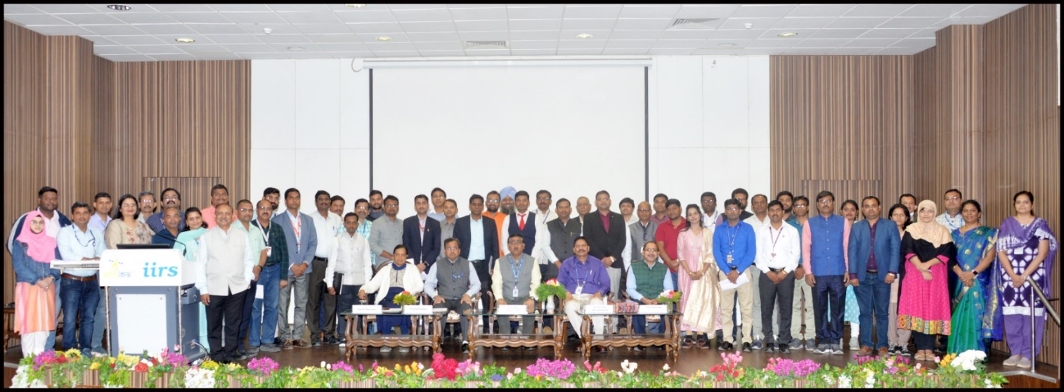
Participation of MH Coordinator in Annual Coordinators Meet at IIRS Dehradun 27 March 2023
Posters of the Online Courses on College Website
Report of the IIRS Nodal Centre for the IIRS Course Calendar Year 2023 (Jan-Dec)
Miranda House, as nodal centre of outreach programme of Indian Institute of Remote Sensing (IIRS), conducted several online courses and workshops in 2023 starting from an overview of space technology in Hindi, specialized courses like Geospatial data processing with Python, a 4-month long course on Basics of Remote Sensing, GIS and GNSS and so on. These courses helped students to build abilities in geospatial technology and their applications. The curricula for the courses are based on the most recent advancements and trends in geospatial science and technology, with a particular emphasis on Indian case studies for geospatial applications. E-learning live sessions were delivered using interactive 2D and 3D animations, audio and video for practical examples, as well as software operations with free data applications. The learning approaches made the program more interactive and learner-centric, with practical examples of real-world challenges. Students from a variety of departments, including Geography, Political Science, Computer Science, Physics and BA Multidisciplinary programme attended the e-classes from the portal. Attendance is monitored online on daily basis. For some of the courses, an online exam was also conducted under the supervision of course coordinators. In 2023, a total of 23 courses were conducted by the nodal centre wherein 69 successful participants received certificates through email.
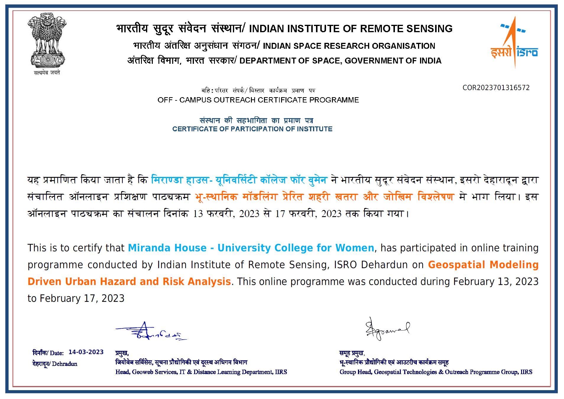
Institute Certificate
Course -wise details of nodal centre:
Courses workshops conducted by Nodal Centre
Courses workshops conducted by Nodal Centre 2023-24
IIRS Nodal Centre Miranda House, has received positive feedback from participants, highlighting the effectiveness of the training programs in enhancing their skills and understanding of remote sensing applications. These courses promote academic growth through knowledge gain, expert assistance, structured curriculum, access to electronic resources, time management, and certification. The nodal centre continues to play a pivotal role in preparing the students to be part of skilled workforce for the geospatial industry. Calendar of courses to be organised in 2024 can be obtained from the following link: